- Products ProductsLocation Services
Solve complex location problems from geofencing to custom routing
PlatformCloud environments for location-centric solution development, data exchange and visualization
Tracking & PositioningFast and accurate tracking and positioning of people and devices, indoors or outdoors
APIs & SDKsEasy to use, scaleable and flexible tools to get going quickly
Developer EcosystemsAccess Location Services on your favorite developer platform ecosystem
- Documentation DocumentationOverview OverviewServices ServicesApplications ApplicationsDevelopment Enablers Development EnablersContent ContentHERE Studio HERE StudioHERE Workspace HERE WorkspaceHERE Marketplace HERE MarketplacePlatform Foundation and Policy Documents Platform Foundation and Policy Documents
- Pricing
- Resources ResourcesTutorials TutorialsExamples ExamplesBlog & Release Announcements Blog & Release AnnouncementsChangelog ChangelogDeveloper Newsletter Developer NewsletterKnowledge Base Knowledge BaseFeature List Feature ListSupport Plans Support PlansSystem Status System StatusLocation Services Coverage Information Location Services Coverage InformationSample Map Data for Students Sample Map Data for Students
- Help
Feature Tile Assignment
In many cases, map feature geometries can span across multiple tiles, based on the feature. For example, long linear features such as rivers or railroad or large polygons as natural parks, or municipality boundaries.
When features span across multiple tiles, the feature is only included in one of the many tiles its geometry traverses. By convention, the tile the feature is associated to is the tile where its southern/western most shape point is located.
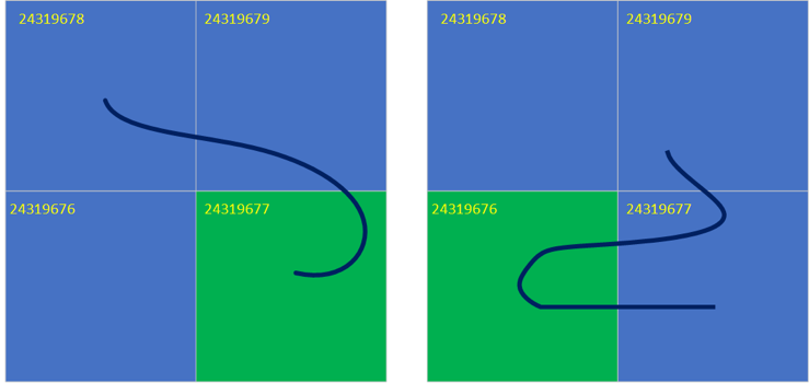
In the examples below on the left, two linear features span across multiple tiles, one having its southernmost point in the bottom right tile (left picture), the other having its southernmost point which is further west on the bottom left tile. These features will be included in the corresponding reference tile per convention, respectively tile 24319677 and tile 24319676.
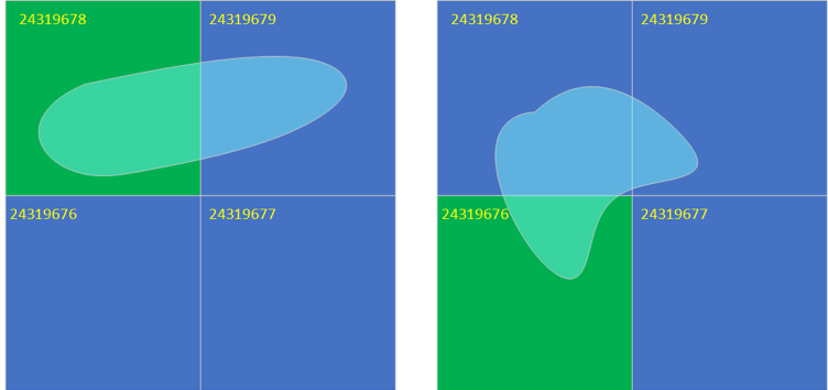
In these other examples, two polygonal features span across multiple tiles, one having its southernmost point in the top left tile (left picture), the other having its southernmost point in the bottom left tile. These features will be included in the corresponding reference tile per convention, respectively tile 24319678 and tile 24319676.
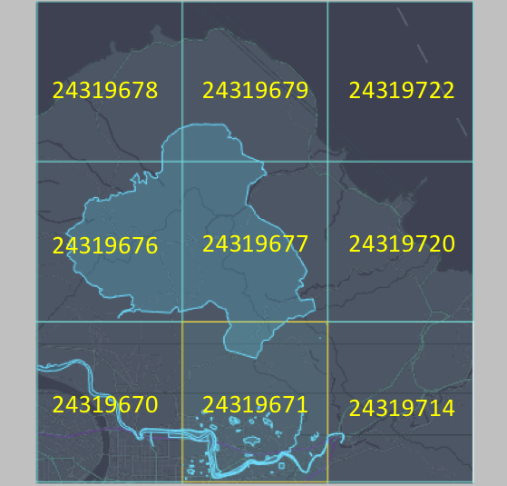
In the real-life example below, the highlight polygon is associated with tile 24319671, as the polygon geometry has its southernmost shape point in this tile.